I was having a look at satellite photos to check on the snow melt in the prairies and wondering if the Saskatchewan Rivers were opening up. Indeed, the North Saskatchewan River seems to be opening up. All of the prairies are covered in snow with the exception of southern Alberta and southwestern Saskatchewan. Then I noticed a peculiar dark patch surrounding Fort McMurray. It seems that this one spot in northern Alberta has also had it's snow melted, or the snow is dark in colour. It just happens that the area closely corresponds to the bitumen sands (aka tar sands) and the oil processing facilities there. Go figure.
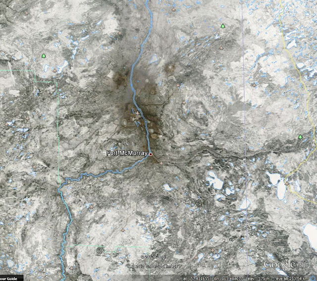 |
| Daily satellite image from 24/04/2013 viewed as a Google Earth overlay. The dark region is in stark contrast to the white of the remainder of northern Alberta and Saskatchewan. |
The image above is a cropped view of the satellite image (find the original at
http://lance-modis.eosdis.nasa.gov/imagery/subsets/?subset=AERONET_Fort_McMurray.2013114.terra.250m) from yesterday viewed via Google Earth. The river heading south to north is the Athabasca River and the Clearwater River joins at Fort McMurray flowing west out of Saskatchewan. The brown area amounts to about 90 km north and south, and about 35 km east and west.
By the way, the above effect is not simply due to urbanization. The larger cities of Edmonton & Saskatoon look much more white than the area around Fort Mac.
